


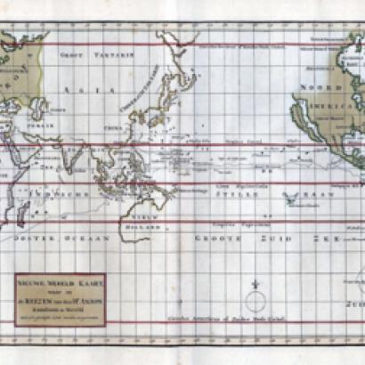
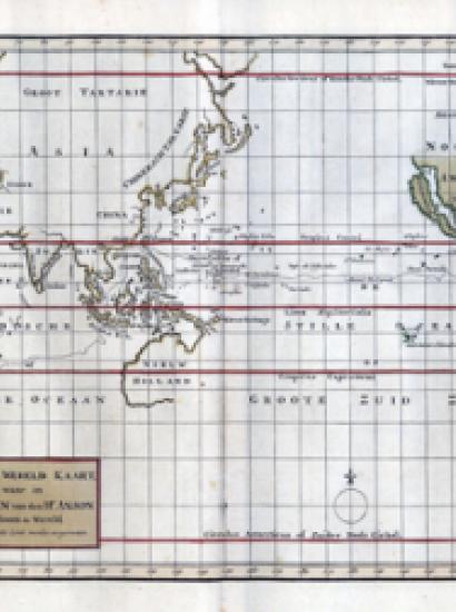
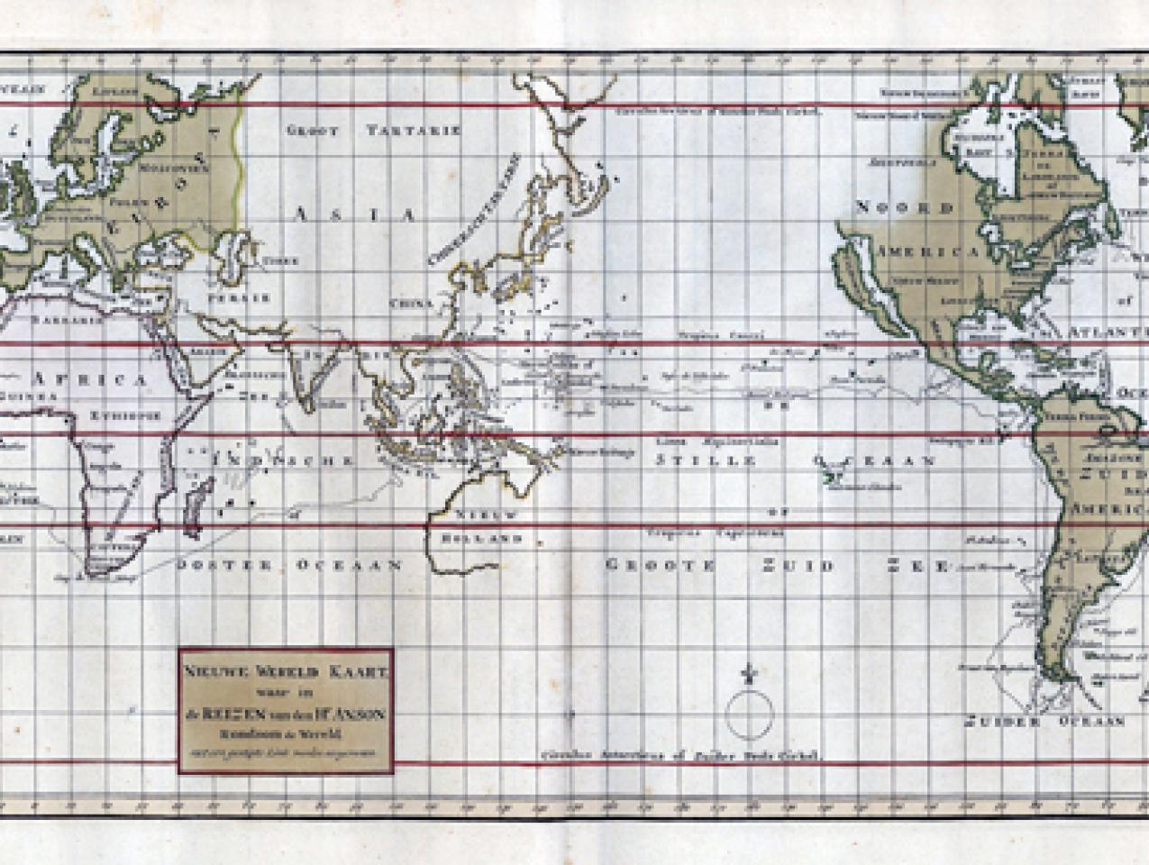
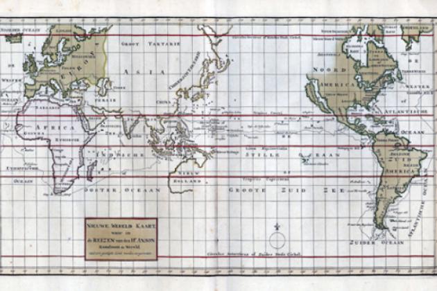
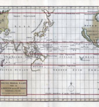
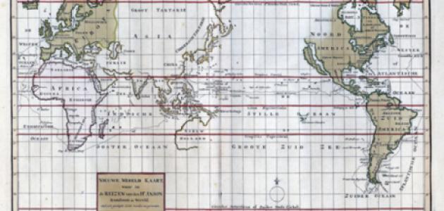
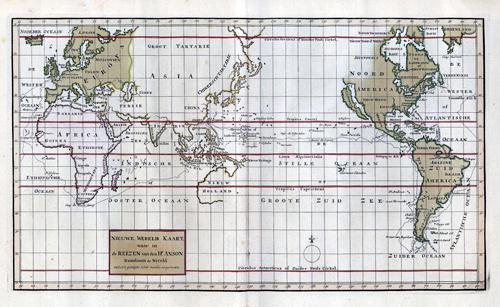
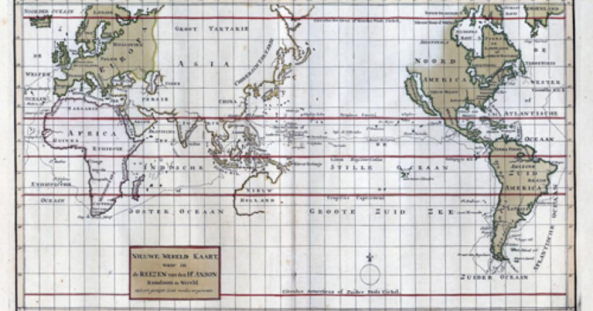

The Maude Cleveland miscellany collection includes a world map that depicts our home state of California as an island. The map, likely printed in Amsterdam around 1750 and titled NIEUWE WERELD KAART, was created by Baron George Anson, a British admiral known for his circumnavigation of the globe and his oversight of the Royal Navy during the Seven Years' War.
In 1740, Anson led eight ships on a mission to capture Spain's Pacific possessions. He returned to Britain by way of China four years later with only one surviving ship and horrific losses as a result of disease. Anson's chaplain, Richard Walter, described the circumnavigation in A Voyage Round the World published in 1748. Read a version published in 1901 through Project Gutenberg and follow along on the map!